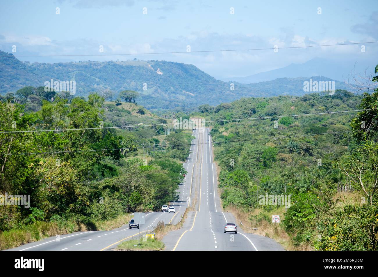
The Pan-Philippine Highway, also known as the Maharlika Highway (Tagalog: Daang Maharlika; Cebuano: Dalang Halangdon), is a network of roads, expressways, bridges, and ferry services that connect the islands of Luzon, Samar, Leyte, and Mindanao in the Philippines, serving as the country's principal transport backbone. Measuring 3,379.73 kilometers (2,100.07 mi) long excluding sea routes not counted by highway milestones, it is the longest road in the Philippines that forms the country's north–south backbone component of National Route 1 (N1) of the Philippine highway network. The entire highway is designated as Asian Highway 26 (AH26) of the Asian Highway Network.
The northern terminus of the highway is in front of the Ilocos Norte Provincial Capitol in Laoag and the southern terminus is near the Zamboanga City Hall in Zamboanga City.
History
The Pan-Philippine Highway System was an infrastructure program of President Diosdado Macapagal as a first priority project for the improvement and expansion of Philippine highway and land transport networks. It was stated in his final State of the Nation Address in 1965 that the project requires the concreting of 3,003 kilometers (1,866 mi) from 1965 to 1969, which continued into the administration of President Ferdinand Marcos. This included the construction of 11,333 bridges, comprising the entire system. It is a mixture of old existing roads and new roads that would be eventually added to become part of the highway. Government planners believed that the motorway and other connected roads would stimulate agricultural production by reducing transport costs, encourage social and economic development outside existing major urban centers such as Manila, and expand industrial production for domestic and overseas markets. Construction, which continued in the following decades, was supported by loans and grants from foreign aid institutions, including the World Bank. In 1979, the highway was renamed to Maharlika Highway.
The highway was rehabilitated and improved in 1997, during the administration of President Fidel V. Ramos, with assistance from the Japanese government, and dubbed the "Philippine-Japan Friendship Highway". Japan's assistance is applied only up to Carmen, Davao del Norte at the south, thus covering only about 2,100 kilometers (1,300 mi) or about 62% of the highway's entire length. In 1998, the Department of Tourism designated 35 sections of the highway as "Scenic Highways", with developed amenities for travelers and tourists.
Asian Highway Network
The Pan-Philippine Highway is designated as AH26 in the Asian Highway Network, a cooperative project which seeks to improve highway systems and standards across the continent. Ratified by the Philippines in 2007, it is currently the only highway in the system that is isolated from every other highway; island-based sections of the Asian Highway Network in Japan (AH1), Sri Lanka (AH43) and Indonesia (AH2) are all linked to the mainland sections by ferries to South Korea (AH1), India (Dhanushkodi), and Singapore, respectively. Despite its isolation, it can be linked internationally via ferry routes such as Laoag–China and Zamboanga–Malaysia.
Route description
AH26 officially runs along the following thoroughfares:
- N1: Laoag – Guiguinto
- Manila North Road/Maharlika Highway: Laoag – Burgos – Aparri
- Bangag-Magapit Road: Aparri – Lal-lo
- Cagayan Valley Road: Lal-lo – Tuguegarao
- Maharlika Highway: San Pablo – Ilagan – Santiago – Solano – Bayombong – San Jose City – Cabanatuan – Gapan – San Miguel – Baliuag – Pulilan – Guiguinto
- E1: Guiguinto – Quezon City
- North Luzon Expressway: Santa Rita Interchange – Balintawak Interchange
- N1: Quezon City – Makati
- EDSA (Eastern Route): Balintawak Interchange – Magallanes Interchange
- E2: Makati – Calamba
- South Luzon Expressway: Magallanes Interchange – Calamba Exit
- N1: Calamba – Matnog
- Maharlika Highway: Calamba – Santo Tomas – San Pablo – Tiaong – Candelaria – Sariaya – Tayabas
- Lucena Diversion Road: Tayabas – Lucena – Pagbilao
- Maharlika Highway: Pagbilao – Gumaca – Calauag – Daet – Milaor – Naga City – Daraga – Sorsogon City – Matnog
- Gap (San Bernardino Strait)
- Matnog–Allen ferry line: Luzon – Visayas
- N1: Allen – Calbayog – Catbalogan – Tacloban – Palo – Mahaplag – Liloan
- Gap (Bohol Sea)
- Liloan–Lipata ferry line: Visayas – Mindanao
- N1: Surigao City – Zamboanga City
- Maharlika Highway: Surigao City – Kitcharao
- Surigao-Butuan National Highway: Kitcharao – Butuan
- Davao-Agusan National Highway: Butuan – Bayugan – Tagum – Davao City
- J.P. Laurel Avenue: Davao City
- C.M. Recto Avenue: Davao City (one-way street)
- Davao–Cotabato Road: Davao City – Digos
- Digos-Makar Road: Digos – Malungon – General Santos
- Marbel-Makar Road: General Santos – Polomolok – Koronadal
- Cotabato-Marbel Road: Koronadal – Banga – Surallah – Norala
- Isulan-Surallah Road: Isulan
- Marbel-Allah Valley-Cotabato Road: Isulan – Cotabato City
- Cotabato-Lanao Road: Cotabato City – Matanog
- Cotabato–Malabang–Lanao del Norte Road: Sultan Dumalondong – Picong
- Malabang–Dobleston–Tukuran Road: Sultan Naga Dimaporo
- Tucuran Junction–Karomatan Junction Road: Tukuran
- Maharlika Highway: Tukuran – Pagadian– Ipil – Tungawan – Zamboanga City
Auxiliary Routes
Alternatively, AH26 runs along the following thoroughfares:
- Luzon (West Metro Manila)
- N1: Quezon City – Caloocan
- EDSA (Western Route): Balintawak Interchange – Monumento
- N120: Caloocan – Pasay
- Samson Road: Caloocan
- Gen. San Miguel Street: Caloocan
- C-4 Road: Caloocan – Malabon – Navotas
- R-10: Navotas
- Mel Lopez Boulevard: Manila
- Bonifacio Drive: Manila
- Roxas Boulevard: Manila – Pasay
- N1: Pasay – Makati
- EDSA (Western Route): Roxas Boulevard – Magallanes Interchange
- Luzon (South Skyway)
- E2: Makati – Muntinlupa
- Skyway: Makati – Muntinlupa
- Visayas
- N70: Palo – Ormoc
- Gap (Camotes Sea)
- Ormoc–Cebu ferry line
- Mindanao
- N10: Davao City – Cagayan de Oro
- Bukidnon–Davao Road: Davao City – Quezon – Maramag
- Sayre Highway: Maramag – Malaybalay – Cagayan de Oro
- N9: Cagayan de Oro
- N946: Cagayan de Oro
Intersections
- Ilocos Norte
- N122 in Bacarra
- Cagayan
- N223 in Abulug
- N121 in Abulug
- N101 / N119 at Magapit Interchange, Lal-lo
- N104 in Tuguegarao
- N105 in Tuguegarao
- N51 / N106 in Tuguegarao
- N104 in Tuguegarao
- Isabela
- N220 in Cabagan
- N53 in Cauayan
- N51 in Santiago
- N108 in Cordon
- Nueva Vizcaya
- N109 in Bagabag
- N110 in Aritao
- Nueva Ecija
- N56 / N111 in San Jose
- N114 in Santo Domingo
- N111 in Cabanatuan
- N58 in Santa Rosa
- N3 in Gapan
- Bulacan
- N247 in San Rafael
- N115 in Pulilan
- N116 in Plaridel
- E1 / N1 in Santa Rita, Guiguinto. Route number change from N1 to E1.
- N247 in Balagtas
- E1 in Balagtas
- N117 in Meycauayan
- Metro Manila
- N118 in Valenzuela
- E5 at Harbor Link Interchange, Valenzuela
- N127 in Unang Sigaw, Quezon City
- N1 / N160 at Balintawak Interchange, Quezon City. Route number change from E1 to N1.
- N127 in Unang Sigaw, Quezon City
- N129 in Muñoz, Quezon City
- N171 / N173 in Diliman, Quezon City
- N170 in Diliman, Quezon City
- N172 / N174 in Diliman, Quezon City
- N180 / N59 in Cubao, Quezon City
- N185 near Camp Aguinaldo, Quezon City
- N184 / N60 at Ortigas Interchange in Quezon City and Mandaluyong
- N141 in Mandaluyong
- N190 (Kalayaan Avenue) in Makati
- N191 in Makati
- N190 (Gil Puyat Avenue) in Makati
- N1 / N145 at Magallanes Interchange, Makati. Route number change from N1 to E2.
- E6 in Taguig
- N11 in Taguig
- N63 in Parañaque and Muntinlupa
- N1 in Alabang, Muntinlupa
- E2 (MCX) in Muntinlupa
- Cavite
- N65 in Carmona
- Laguna (Biñan–Calamba)
- E3 (CALAX) in Biñan
- N420 in Santa Rosa
- E2 / N1 in Calamba. Route number change from E2 to N1.
- Batangas
- E2 in Santo Tomas
- N4 in Santo Tomas
- Laguna (Alaminos–San Pablo)
- N421-1 in Alaminos (western & eastern termini)
- N67 in San Pablo (two southern termini)
- Quezon
- N608 in Tiaong (northern terminus)
- N435 in Tiaong
- N608 in Tiaong (southern terminus)
- N609 in Candelaria (western & eastern termini)
- N606 in Sariaya
- N606 in Isabang, Tayabas
- N422 in Isabang, Lucena
- N603 in Gulang-Gulang, Lucena
- N606 in Talipan, Pagbilao
- N610 in Silangang Malicboy, Pagbilao
- N613 in Gumaca
- N612 in Lopez
- N657 in Lopez
- Camarines Norte
- N68 in Santa Elena
- N620 in Labo
- N621 in Daet (northern & southern termini)
- Camarines Sur
- N68 in Sipocot
- N623 in Pamplona
- N672 in Pili
- N673 in Pili
- N630 in Pili
- N634 in Baao
- N634 in Nabua
- N635 in Bato
- Albay
- N638 in Polangui (two northern termini)
- N639 in Ligao
- N636 in Ligao
- N630 in Daraga
- Sorsogon
- N642 in Pilar
- N641 in Castilla
- N643 in Sorsogon City (western terminus)
- N644 in Sorsogon City
- N643 in Sorsogon City (eastern terminus)
- N645 in Bulan
- Northern Samar
- N670 in Allen
- Samar
- N672 in Calbayog
- N673 in Calbayog
- N677 in Gandara (northern & southern termini)
- N675 in Catbalogan
- N674 in Paranas
- N670 in Basey
- N670 in Santa Rita
- Samar–Leyte boundary
- San Juanico Bridge
- Leyte
- N686 in Tacloban
- N687 in Tacloban
- N686 in Palo
- N70 in Palo
- N690 in Abuyog
- N70 in Mahaplag
- Southern Leyte
- N692 in Sogod
- N690 in Liloan
- N691 in Liloan
- Surigao del Norte
- N901 in Surigao City
- N902 in Placer
- Agusan del Norte
- N9 in Butuan
- Agusan del Sur
- N903 in Prosperidad
- N904 in Prosperidad
- N905 in San Francisco
- N904 / N73 in Trento
- Davao de Oro
- N906 in Montevista
- N907 in Nabunturan
- Davao del Norte
- N908 in Tagum (northern terminus)
- N909 / N74 in Tagum
- N908 in Tagum (southern terminus)
- N910 in Carmen
- N909 in Panabo
- Davao del Sur
- N913 in Panacan, Davao City (eastern terminus)
- N914 in Buhangin, Davao City
- N915 in Buhangin, Davao City
- N916 in Agdao, Davao City (eastern terminus)
- N917 in Agdao, Davao City
- N918 in Agdao & Buhangin, Davao City
- N919 / N920 in Poblacion, Davao City
- N919 in Poblacion, Davao City
- N920 in Poblacion, Davao City
- N921 in Talomo, Davao City
- N916 in Talomo, Davao City (western terminus)
- N913 in Talomo, Davao City (western terminus)
- AH 26 (N10) in Talomo, Davao City
- N916-1 in Bago Aplaya, Davao City
- N923 in Digos (northern terminus)
- N75 in Digos
- N924 in Digos
- N923 in Digos (southern terminus)
- N930 in Sulop
- South Cotabato
- N931 in General Santos (eastern terminus)
- N930 in General Santos
- N935 in General Santos
- N931 in General Santos
- Sultan Kudarat
- N940 in Tacurong
- N932 in Surallah
- N76 in Isulan
- N941 in Esperanza
- Maguindanao del Sur
- N933 in Datu Saudi Ampatuan
- Maguindanao del Norte
- N75 in Sultan Kudarat
- N935 in Datu Odin Sinsuat
- N936 in Datu Odin Sinsuat
- N937 in Datu Mastura
- N937 in Parang
- N939 in Parang
- Lanao del Sur
- N77 in Malabang
- Zamboanga del Sur
- N9 in Tukuran
- Zamboanga Sibugay
- N79 in Ipil
- Zamboanga City
- N972
- N968
- N966 / N970 / N971. Southern terminus of AH26.
Auxiliary routes
- Metro Manila (western route) – part of N1 and N120
- N1 / N160 / E1 in Balintawak, Quezon City. Northern terminus of AH26 auxiliary route in Metro Manila.
- N1 / N150 in Caloocan. Route number change from N1 to N120.
- N130 in Navotas
- E5 in Navotas
- N140 in Tondo, Manila
- N145 in Tondo and San Nicolas, Manila
- N150 in Ermita and Intramuros, Manila
- N155 in Ermita, Manila
- N156 in Ermita, Manila
- N140 in Malate, Manila
- N190 in Pasay
- N61 in Pasay. Route number change from N120 to N1.
- N170 in Pasay
- N171 (Aurora Boulevard) in Pasay
- N1 / N145 / E2 at Magallanes Interchange, Makati. Southern terminus of AH26 auxiliary route in Metro Manila.
- Visayas (western route) – part of N70
- N1 in Palo. Northern terminus of AH26 auxiliary route in Visayas.
- N681 in Capoocan
- N683 in Ormoc
- N684 in Ormoc
- N70 in Ormoc
- Mindanao – part of N10 and N9
- N1 in Davao City. Southern terminus of AH26 auxiliary route in Mindanao.
- N942 in Arakan
- N943 in Maramag
- N912-1 in Maramag (southern terminus of southern section)
- N912 in Valencia
- N912-1 in Valencia (northern terminus of southern section)
- N912-1 in Malaybalay (northern & southern terminus of northern section)
- N946 in Cagayan de Oro
- N862 in Cagayan de Oro
- N946 in Cagayan de Oro
- N945 / N9 in Cagayan de Oro
- N862 in Cagayan de Oro
- N946 in Cagayan de Oro
See also
- Transportation in the Philippines
- Department of Public Works and Highways
- Asian Highway Network
- Philippine Nautical Highway System
Notes
Alternative names
Pan-Philippine Highway also has alternative names, especially locally within the poblacion of respective town and cities.
References
External links
- Economy